Keywords: Geographic Data management, decision-making
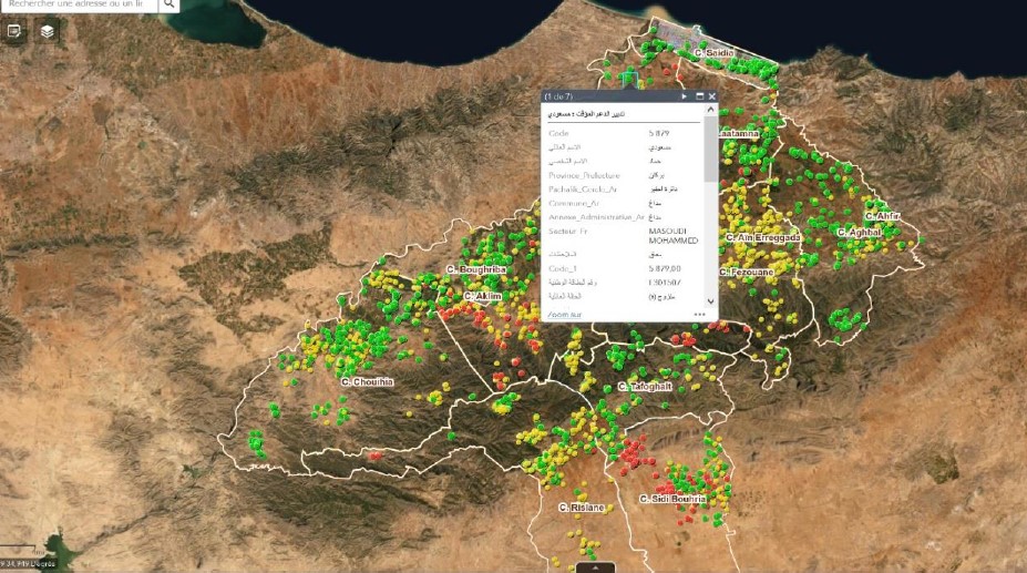
Faced with the lack of data and accessibility for effective decision-making, the difficulty in identifying areas requiring priority intervention and in the presence of a lack of coordination between the different sectors for optimal territorial management, the services of Berkane Province have established a multi-layer and multi-sector integrated geographic information system to promote local efficiency through digital transformation. This system is a local governance cockpit which was able to centralize and analyze geographical data coming from all local actors at the territorial scale according to different datasets shared between them in an approach of co-production and co-construction of a single and consistent decision making. 2. In fact, it is a GIS comprising more than 300 layers of information projected onto a droneMap in perpetual updating instead of the satellite image. It provides decision-makers and decentralized services in the province with a convincing tool for better planning, more relevant targeting and very realistic management of circumstances (cholera, covid, water stress, etc.) 3. see videos below attached